
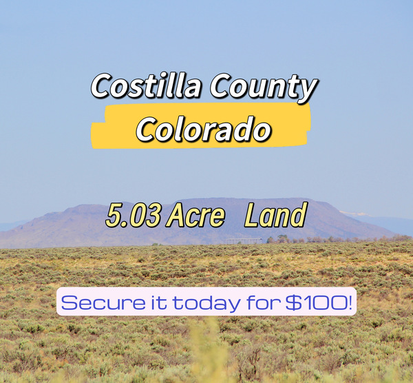
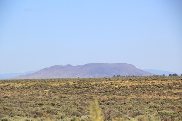


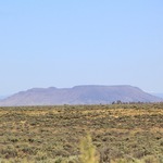


Embrace the quiet majesty of Wild Horse Mesa with this expansive 5.03-acre sanctuary in Costilla County, Colorado. Tucked away on Bronco Lane, this flat, desert-style parcel greets you with breathtaking panoramic views and effortless dirt road access. At an elevation of about 7,670 feet, you’ll wake to crisp mountain air and endless skies.With no HOA restrictions and ultra-low annual taxes, this property is your blank canvas—perfect for creating an off-grid haven, a private campsite, or a smart long-term investment.Adventure is always within reach. Explore local treasures like Cano’s Castle and the Rio Grande del Norte National Monument, or take a scenic drive to Alamosa, Colorado City, Cañon City, and the historic charm of San Luis.Here, nature’s serenity meets wide-open freedom. Don’t miss your chance to claim this remarkable slice of Colorado. Reach out today and make it yours!
Why You’ll Love This Property!
Quiet Seclusion & Big Views: Peaceful Wild Horse Mesa with wide-open desert vistas and star-filled skies.
Standard Acreage: Plenty of room to build, camp, or simply enjoy your own private Colorado retreat.
No HOA & Low Taxes: Enjoy freedom with no homeowners association restrictions and minimal annual costs.
Easy Access: Convenient dirt road access on Bronco Lane makes coming and going simple.
Ideal Elevation: Year-round access to the property, cooler summers, and inspiring landscapes.
Central Location: Quick trips to Alamosa, Colorado City, and Cañon City for shopping, dining, and amenities.
Property Details
Parcel ID:71200220
Acreage: 5.03 acres
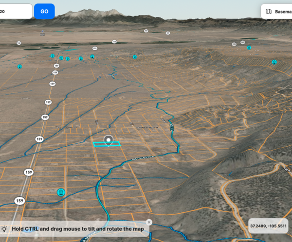
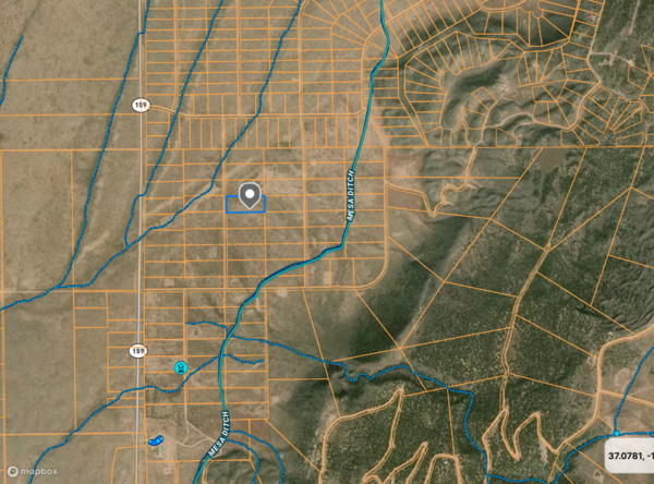
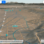
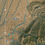
Road Access: Via Bronco Ln, a dirt road maintained by the County.
Legal Description: W.H.M. SECTION A BLK 2 LOT 6 CONT. 5.03 AC
Subdivision/Block: Wild Horse Mesa, Section A, Block 2, Lot 6
Rd Access: Via Bronco Ln, a dirt road maintained by the County.
Google Map: https://www.google.com/maps/search/?api=1&query=37.081508636
47461,-105.51397705078125
Youtube Video Tour : https://youtu.be/-CICTp7YkkM
GPS coordinates centered at 37.081509, -105.513977
Elevation Range: 7666-7677 ft.
Nearby: The Closest highways are US HWY-285 and RT-159.
Major cities/towns nearby: Alamosa, Colorado City, and Cañon City.
Nearby Attractions: Mother Mary's Garden and Rio Grande del Norte National Monument.
Property Taxes: Annual taxes are $54.72
HOA: None in the area.
Utilities: Water by well or cistern (requires a well permit), septic system, power by solar, wind, generator, or Xcel Energy. Natural gas, LP, diesel, or propane tank. Waste pickup service through GT Trash or the transfer station.
Zoning & Use: Zoned Estate Residential (ER), allowing for house construction.
Camping and RVs are permitted for up to 14 days every 3 months.
Mobile homes manufactured after 1976 are allowed.
Pricing and Terms
Terms: $100 down, then $160 monthly for 60 months
or
Cash: $7,500
Doc Fee: $149
The down payment is processed through a secure third party and is 100% refundable for 30 days. A one-time, non-refundable $149 document fee is applied at closing.
We are experienced real estate investors specializing in land.